HPWREN 2021 - 2022 Accomplishments
February 19, 2023
This is a summary of the HPWREN 2021 and 2022 accomplishments. The impact of the 2020 Covid outbreak continued to be felt throughout 2021, while all but diminishing during 2022. Despite related challenges, HPWREN continued to make good progress, including increased bandwidth and network reach, as well as updated technologies. HPWREN accomplishments during this period, in addition to ongoing routine maintenance and repair of infrastructure, included the build out of new camera and network backbone sites with new Ubiquiti and Siae radio equipment, expansions beyond San Diego County into Orange and Riverside counties, and major upgrades to our networking and storage infrastructure. This ultimately culminated in the adoption of AWS cloud storage services.
I. Awards and grants
Support from UCSD Calit2 PRP to expand storage:
- Funded two storage servers at SIO to support a new HPWREN distributed storage system
- Funding matched by HPWREN to fund 2 additional storage servers
- Enabled the transition to AWS for initially the HPWREN's Long Term Archive
-
Support from SDG&E Resilience Program
- Expanding HPWREN connectivity regional coverage, reliability and resilience:
- Upgraded sites at Red Mountain, Coronado Hills, Mt. Woodson, and Birch Hill
- Improve resilience of Cuyamaca Peak infrastructure to ice damage
- Set up new camera sites at Lake Wohlford, Rincon del Diablo, Buffalo Bump, SMER Highlands, SMER Overlook, and Sky Oaks Jolly Roger Relay
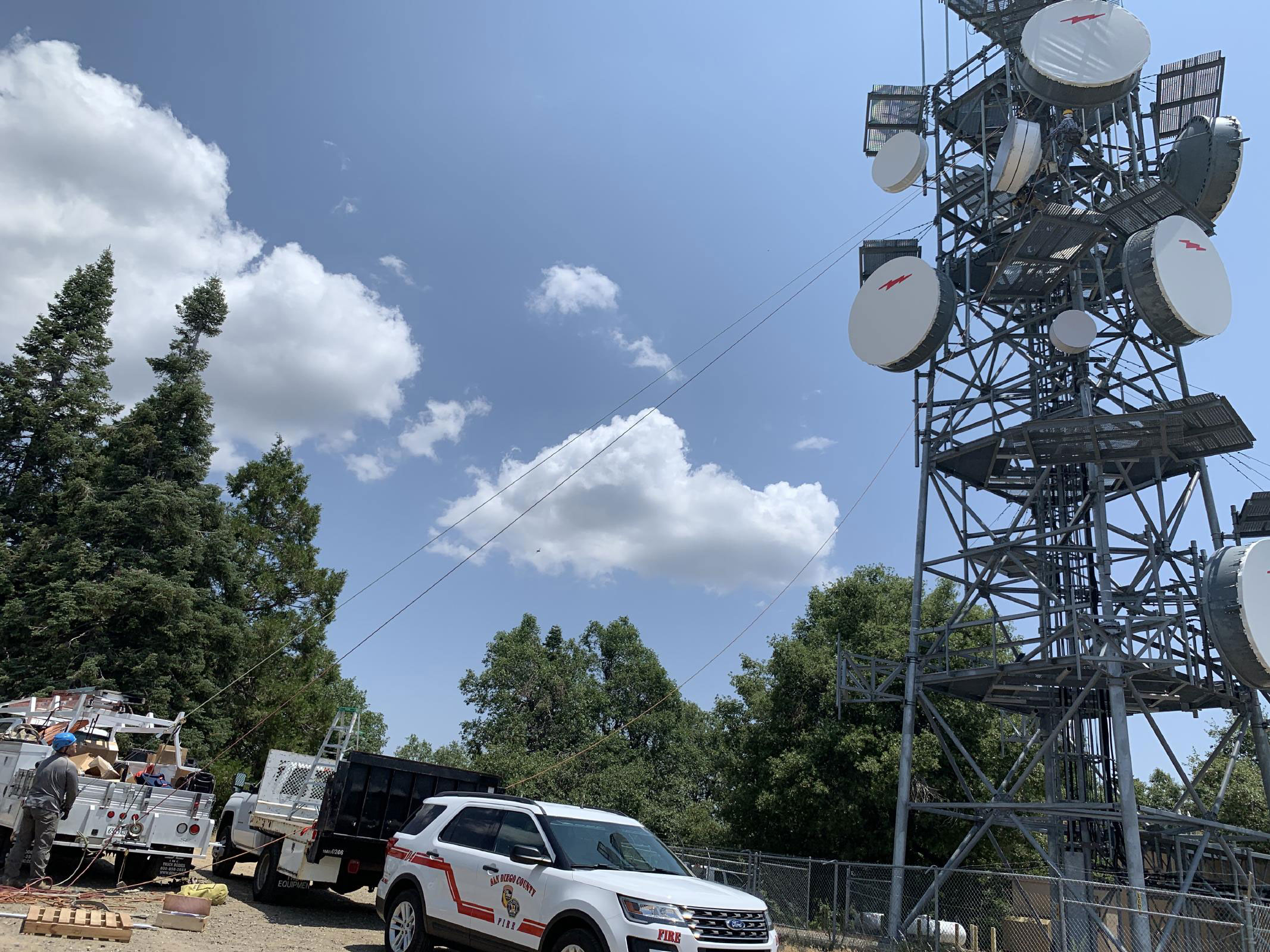
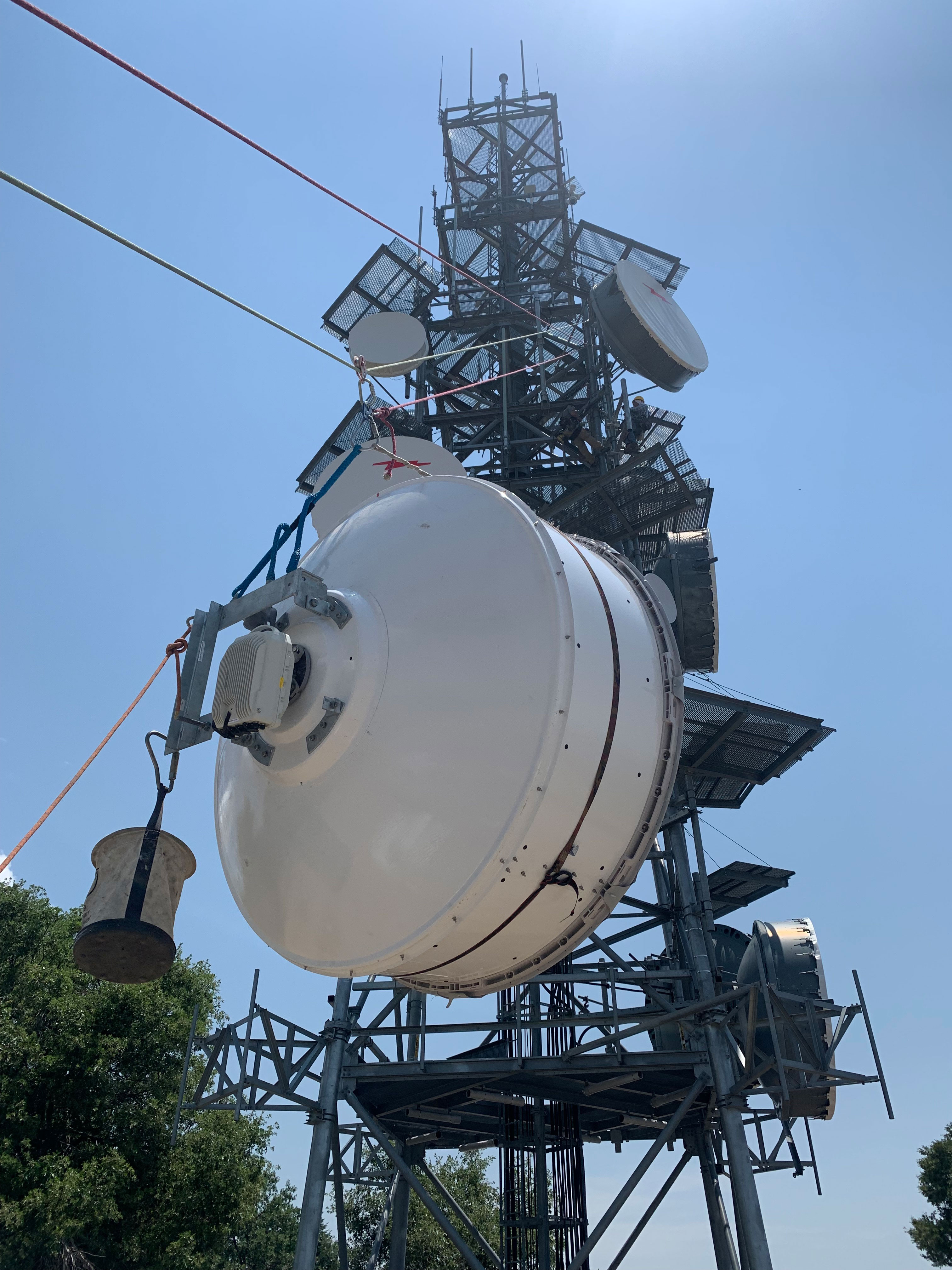
- Upgraded the HPWREN backbone link between Monument Peak and North Peak from 170 Mbits/sec to 1.4 Gbits/sec.
Support from San Diego County Board of Supervisors - Projects completed
- Backbone Links:
- Mt Woodson to North Peak 604 Mbit/sec
- Monument Peak to Cuyamaca 1.4 Gbit/sec
- North Peak to Cuyamaca 1.4 Gbit/sec
- SDSC to Cuyamaca 1.4 Gbit/sec
- SDSC to Woodson 694 Mbit/sec - Camera Sites:
- White Star
- Cuyamaca
- Mesa Grande
- Volcan
- Birch Hill - Support from ALERTCalifornia
Over the past two years, HPWREN has strengthened its partnership with the ALERTCalifornia Program. Starting in 2016 the ALERTWildfire consortium deployed pan-tilt-zoom (PTZ) cameras across California, Nevada and Oregon. During this time of rapid growth, ALERTWildfire grew to include more than 800 PTZ cameras while including near-infrared capabilities. ALERTCalifornia started in 2022 as an outgrowth of ALERTWildfire.
As a state-specific program, ALERTCalifornia is focused on California wildfire monitoring and research efforts. California has more than 163,000 square miles of diverse terrain that requires adaptive fire management across government agencies and novel research. ALERTCalifornia is positioned to work with government agencies, utilities and universities to meet state-specific needs and provide the data required to fill knowledge gaps and inform management decisions. HPWREN has two roles in ALERTCalifornia. The first role is hosting 89 ALERTCalifornia PTZ cameras,and the second is managing the core ALERTCalifornia networking system.
II. HPWREN Sensor Data Use Cases
HPWREN enables end users to utilize the image and collected sensor data to create interesting results. Access to HPWREN data archives is outlined at /news/20210318/ Some of the examples include:
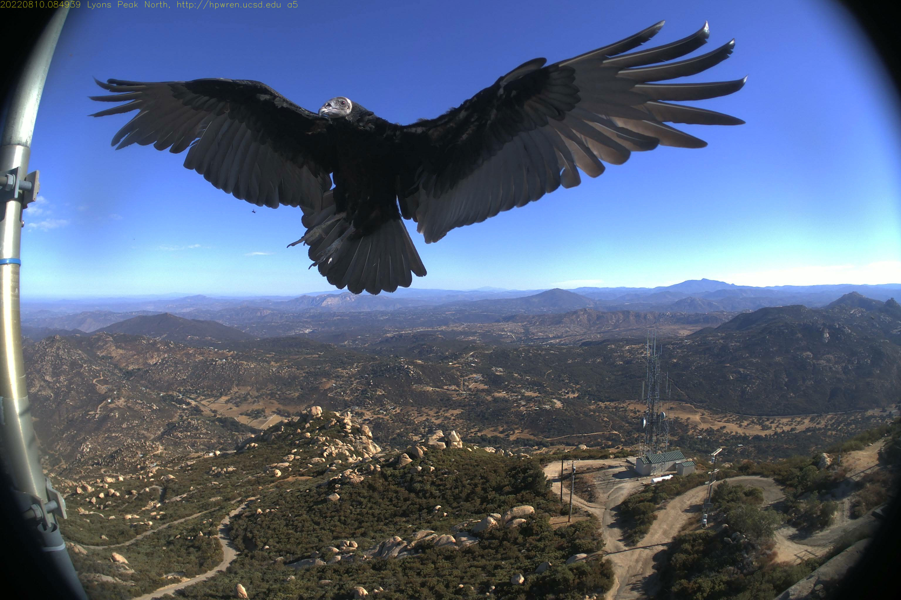
The HPWREN cameras often capture images of meteors streaking through the sky. A particularly good example was identified by HPWREN user Ross Seibert in one image from the west-facing camera at Lyons Peak the night of November 9. [/news/20211201/]
HPWREN imagery was also used by SDSU astronomy researcher Robert Quimbly to demonstrate the effects of light pollution in San Diego [/news/20210928/]
High school student Colin Wessels used air traffic data delivered by HPWREN in his study on how Coronavirus affected air traffic in Southern California [/news/20210826/]
Open Climate Tech, an all volunteer nonprofit, has built an automated early wildfire smoke detection system using images from HPWREN cameras.[/news/20211201/]
-
Members of the Biggs and Mladenov Labs have installed water quality sondes and pressure transducers to measure stream level on Boulder Creek, San Diego River at Mission Trails, and Tijuana Estuary. The systems report the data in real-time via HPWREN.[ /news/20210323/]
A request from an outside researcher looking for access to 1 Hz wind data from HPWREN meteorological sensors led to the creation of a large downloadable data set across many years.[/news/20220812/]
At the request of the San Diego River Park Foundation, HPWREN has provided cameras and instrumentation at the Boulder Creek Preserve Environmental Monitoring Research Program [/news/20220315/]
III. ASAPNET
Advanced Situational Awareness for Public Safety Network (ASAPNet) is a wireless network primarily serving fire stations in remote areas of San Diego County. ASAPNet is an extension to and utilizes UCSD's High Performance Wireless Research Network (HPWREN) as the "backbone" wide area network. Currently ASAPNet comprises 56 fire stations, and 12 relay sites originating from 19 mountaintops in San Diego County.
IV. Public Safety Service Improvements
New back county resource centers were established by SDG&E and provided Internet access by HPWREN. These Community centers are activated as part of the Public Safety Program when power is dropped in the area during red flag warnings. These Community Centers include:
Dulzura Community Center - Internet access provided via Lyons Peak
Lake Morena Community Church -Internet access added via Los Pinos
Potrero Community Center -Internet access added via Los Pinos
Pine Valley Improvement Club - Internet access added via Cuyamaca Peak
From a wildfire observation perspective, many existing sites received new and/or upgraded cameras, and new sensor sites were added to the network. In some cases radio links of existing sites were upgraded as well. In addition, the HPWREN regional wireless backbone underwent numerous expansions.
In support of the growing ALERTCalifornia community, HPWREN provides high quality Internet connectivity using fixed wide area wireless technology connected to multiple regional Internet gateways at sites in San Diego, Orange, Los Angeles, Riverside and Santa Barbara Counties. In partnership with ALERTCalifornia and LA City Fire Department, the following new camera sites were deployed in the Santa Monica Mountains:
- San Vicente Peak
- Westridge
- Canyonback
- Mt. Lee (Hollywood)
- Temescal Water Tank
In partnership with ALERTCalifornia, the following new camera sites were above the Owens Valley:
- Silver Mountain, partnering with the Bishop Fire Dept
- Marzano, partnering with the Big Pine Fire Dept
HPWREN new or upgraded camera sites, by region, include:
- San Diego County
- Coronado Hills
- Cuyamaca Peak
- Los Pinos
- Lyons Peak
- Otay Mountain
- San Miguel
- Santa Margarita Ecological Reserve
- Sky Oaks
- Red Mountain
- Volcan Tract III
- Mesa Gande
- Buffalo Bump
- Rincon Del Diablo (Escondido)
- Tijuana Estuary
- Orange County
- Chino Hills
- Los Angeles
- San Vicente Peak
- Westridge
- Canyonback
- Temescal
- Mount Lee
- Riverside County
- Toro Peak
- Lake Perris
- Santiago Peak
- Major wireless network and backbone improvements:
- Sky Oaks - upgraded links to
- High Point
- Mesa Grande
- 69 Bravo - new or upgraded links to
- Green Mountain
- Temescal Water Tower
- Coronado Hills - new links
- Lake Wohlford
- Mt Woodson
- Buffalo Bump - new links to
- Red Mountain
- San Juan Hills
- Red Mountain - new or upgraded links to
- Rainbow
- Buffalo Bump
- Santiago Peak
- Cuyamaca Peak - new or upgraded links to
- Los Pinos
- SDSC
- North Peak
- Monument Peak
- SDSC - new links to
- Boucher Hill
- Cuyamaca Peak
- Santiago Peak (CalOES tower) - new links to
- Red Mountain
- UCI
- Lake Perris
- Signal Peak - new links to
- Laguna Hills (Orange County)
- UCI
- Upper Talega
- UCI - new links to
- Santiago Peak
- Signal Peak
V. IT Infrastructure Improvements
HPWREN has been systematically upgrading wireless network radios to support additional throughput and broader connectivity (see Section IV). Worth noting is the migration to more modern Siae Microwave communications equipment on more than a dozen links.
On the storage front, numerous storage evaluations and improvements have taken place. Being significantly pressed for image capture (near term) storage, incremental storage of around 100 Terabyte was added to our archival servers.
We invested in additional local storage servers and investigated options for building a new distributed storage system. Ultimately, we decided to use our new server hardware to provide improved processing and storage power for our camera image fetch workflows (currently done predominately on VMs). This addresses our shorter term storage needs. We are now adopting cloud storage for our longer term storage requirements. Adoption of AWS Cloud storage, enabled via Calit2, was begun to provide regional storage independence and high availability to our users. The system has been designed and initially adopted in late 2022 for bulk storage. The new storage system will initially host archival data and eventually provide various web accessible data services, including to students.
Website improvements this year include significant improvements in performance and navigation. The camera banner page is more responsive to screen changes such as resizing or rotation, adding more support for various device types, sizes and display capabilities. The "details" pointers refer to more information about the camera or camera collage at specific sites. The cameras are now sorted alphabetically, and different sort order options will be added over time.
HPWREN routers at SDSC/UCSD and UCI have been upgraded to 2x20GigE throughput capabilities.
We have incorporated Netbox among our software tools to help keep track of various software, hardware and networking configurations.
VI. Public Outreach
The many ways we have reached out to the public this period include:
- Posted numerous interesting and informative YouTube videos
- See 25 or so 2021 and 2022 videos (animations, split screens, surround views, etc.) of fires and interesting events captured by HPWREN cameras at https://www.youtube.com/user/hpwren/videos
- Posted new content on the website
- Read more about HPWREN accomplishments, cameras, fire monitoring, in 2021 and 2022 news articles at /news/.
- Boosted social media presence and increased followings on:
- Facebook: https://www.facebook.com/HPWREN.UCSD.EDU
- Twitter: https://twitter.com/hpwren
- YouTube: https://www.youtube.com/user/hpwren/videos
- Significantly improved user interface to HPWREN web site
- See /news/20220705/ for details
VII. Research and Development
HPWREN infrastructure supports a variety of research and education projects and we are always looking for new ways to do things or new capabilities to add. The more significant activities this period include:
Completed proof-of-concept generation “getcams” image fetching environment development, including testing with multiple distributed storage options across regions. The experimental system ran as a service, spawning and maintaining a single, long running process per camera. We have been able to handle concurrent fetching from 150 cameras once per minute using a single 4 Core 4 GB VM. The system allows image load to be spread across multiple servers as needed to support flexible scaling. The prototype system has been tested at both UCSD and UCI. There is also a container based version of the getcams system that was developed in parallel. This system was originally anticipated to upgrade legacy systems as deemed appropriate.
Building on the "getcams" system, the PRP (Pacific Research Platform) and Calit2 (at UCSD and UCI) established an experimental Calit2@UCI repository for Orange County HPWREN fire camera images. This Calit2/HPWREN collaboration was initially implemented during 2020 on a virtual machine environment, and expanded and integrated into a container based application in 2021. The container based and VM based applications share common source code and configuration files. Their UCI implementation supported Orange County camera images that were fetched, stored and published using NextCloud @UCI. NextCloud supports camera image exploration, access and bulk download using a point and click web based interface.
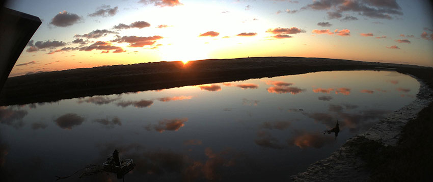
Late 2022, with camera images provided by the Valley Center Municipal water District (VCMWD), HPWREN is experimenting with 180 degree images, with the initial proof-of-concept via cameras at Sierra Rojo. Next steps include HPWREN testing updated of new camera technologies, perhaps including IPC-PFW8601-A180 and Axis Q3819-PVE 180 degree systems. Further panoramic testing is also planned using the Axis 6010 E 360 camera.
VIII. Anticipated 2023 Activities
Projects left over from 2021/2022 include
Saddleback site construction and backup CENIC network access for HPWREN
High Point upgrade
Little Black upgrade
San Marcos Peak installation
Tecate Peak installation
Riverside County camera sites