|
|
|
|
April 8, 2010
Ground displacement measurements from the Magnitude 7.2 earthquake in Baja California on April 4, 2010 By Yehuda Bock, Research Geodesist, UCSD/SIO Institute of Geophysics and Planetary Physics From an email the author sent around 4:34 PM on April 4, shortly after the quake:
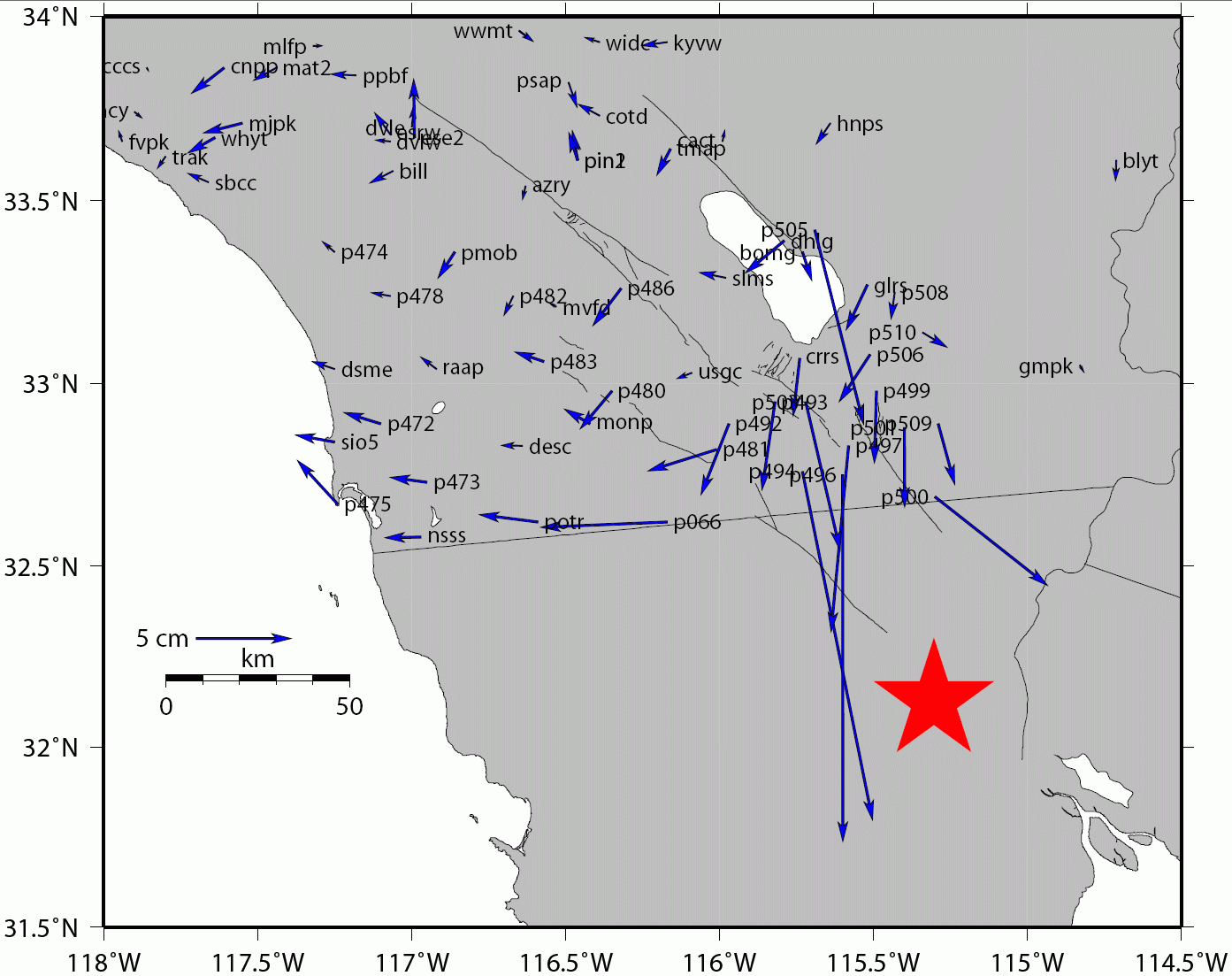
The California Real Time Network (CRTN) is a network of about 130 continuous GPS receivers operated by a number of agencies including Scripps, PBO, USGS, MWD, and Orange and San Diego Counties. Data sampled at once-per-second are collected in real time by a server at Scripps Institution of Oceanography's Institute of Geophysics and Planetary Physics (see http://sopac.ucsd.edu/projects/realtime/). Many of the data streams flow through HPWREN, in particular the ones in Imperial and San Diego Counties, which were closest to the epicenter of the April 4 M7.2 Sierra El Mayor earthquake. The HPWREN connectivity allows us to compute positions of the GPS stations, once per second and with a latency of one second. The time series of these positions provide total displacement waveforms, which record both seismic (dynamic) and static (coseismic) displacements. Note that seismic instruments record only dynamic displacements and many of them clipped during this event. A movie posted on GPS Explorer, maintained by Scripps and JPL, shows the total displacement waveforms in southern California computed with the help of HPWREN during the Sierra El Mayor earthquake. The GPS Explorer data portal can be viewed at http://geoapp03.ucsd.edu/gridsphere/gridsphere. If this is your first visit, create a user account and then proceed to the "Earthquakes" tab.
A pdf and vec file for the above (text file that can be input to GMT plotting program) can be found at anonymous ftp://dozer.ucsd.edu/pub/public/LagunaSalada (filenames: LagunaSalada_CRTN_Coseismic.vec; LagunaSalada_CRTN_Coseis.pdf). |