|
|
|
|
February 3, 2010
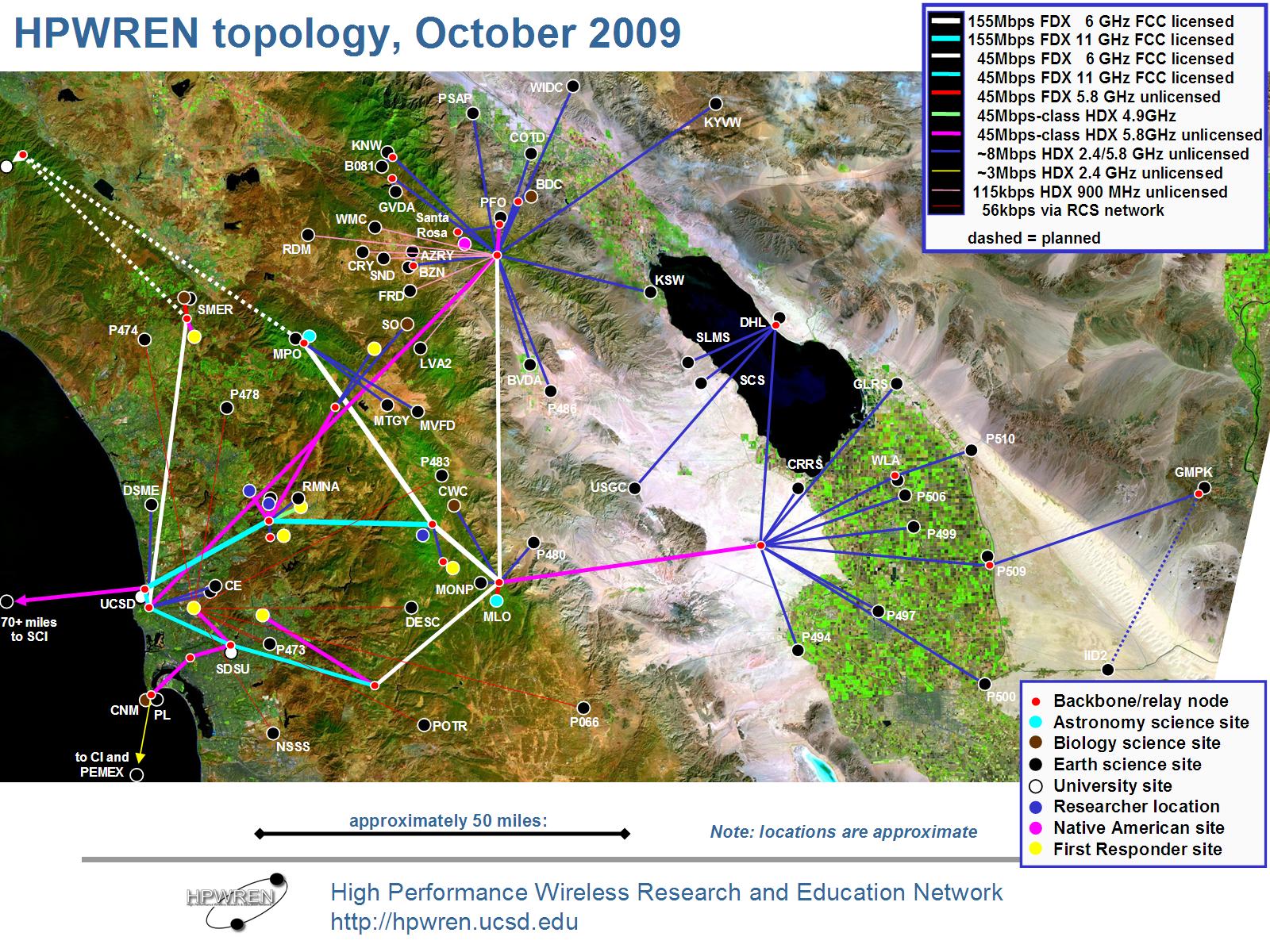
Ten Years of Reducing The Gap: Bringing Speed and Reach to Remote America Note: HPWREN's origins are now more than ten years in the past, with a first actual site survey by the team having been at Mount Woodson on February 3, 2000. The following is a short summary about the HPWREN project. Being in a remote location in the United States must not be allowed as a justification of not being able to be an integral part of society. As such, the University of California San Diego High Performance Wireless Research and Education Network (HPWREN) is an NSF-funded wireless high bandwidth cyberinfrastructure project for research, education, and public safety objectives in rural and remote areas. The Principal Investigator is Hans-Werner Braun at the San Diego Supercomputer Center, co-Principal Investigator Frank Vernon is with the Scripps Institution of Oceanography. The project originated in the year 2000 and has been continually evolving to include various research and education applications in difficult to reach areas, as well as first responder and public safety activities. The network operates in predominantly remote and rugged areas of Southern California, spanning more than 200 miles west-east and about 100 miles north-south: from San Clemente Island in the Pacific Ocean, via the California coast, to the inland valleys and on to the high mountains, reaching an altitude of more than 8700 feet. It then extends across the desert, reaching sites close to the Arizona border. Many scientific disciplines and education activities benefit from the network, including a number of NSF-funded projects. Without access to this high-speed data networking connectivity, many of these various project research objectives would be difficult, and several would even be impossible, to achieve. The collection of real-time data is one of the most valued aspects of the network, such as the deployment of various environmental sensors that enable an understanding of environmental conditions that would be hard to obtain otherwise. Such real-time data allows for increased knowledge and understanding of an array of scientific concepts such as heavily impacted ecological systems on earth and the tracking of transient astronomical events in the universe. Examples of significant accomplishments include the research on network workloads with a highly diverse traffic profile, as well as major discoveries by the Palomar Observatory, providing invaluable assistance during wildland fires, and the social aspects of enlarging Native American contacts with the mainstream population, with major educational benefits being derived from such contact. The current HPWREN workscope is three-fold: (1) maintain and enhance the HPWREN cyberinfrastructure for its many interdisciplinary and multi-institutional research, education, and public safety activities, (2) continue the research on Quality of Service considerations on a highly functional wireless cyberinfrastructure environment, and (3) evaluate transition strategies towards an objective of a more long-term sustainable infrastructure. Broad Impact Throughout its existence, the HPWREN project has been successful in its broader impacts, as evidenced by many news updates on the https://www.hpwren.ucsd.edu web site. While this project directly supported graduate students, other student work and many outside papers at various institutions benefited from HPWREN. For example, Caltech states that many CIT Astronomy and GPS Post-Docs, PhDs, and other graduate students have benefited from the HPWREN/Palomar partnership, and list many journal publications and conference proceedings that were directly or indirectly facilitated by this partnership. Yale University adds two more PhD astronomy students, and the SDSU Mount Laguna Observatory references many journal publications, a large number of Masters theses, a significant set of REU students, as well as two NSF Instrumentation Awards to improve MLO's research facilities. Another significant area of student involvement and journal publications is related to the earth science activities, especially with the UCSD Scripps Institution of Oceanography. HPWREN provides support to large-scale wildland firefighting operations. It connects several first reponder sites, and has provided ad-hoc data connectivity over the years to six Incident Command Posts. Network cameras and sensors on HPWREN are in substantial use by first responders and even the public, with tens of thousands of different Internet addresses having accessed the HPWREN web site a day during the large 2007 southern California wildfires. These fires are also a threat to sites of HPWREN and its project partners. Another significant user of HPWREN cameras is NOAA/NWS, typically downloading more than a gigabyte worth of image data a day from the HPWREN server. HPWREN provides automated pager and email alarms to public safety personnel, alerting them in real-time of Santa Ana conditions based on continuously processed sensor data. The network's first external site was the Pala Native American Reservation, a synergy that has subsequently resulted in technology and expertise transfer to the point where today almost twenty reservations are connected to a tribal-architected, run, and self-sustaining Tribal Digital Village Network infrastructure. TDVNet currently even hosts an HPWREN site at one of their tribal-built microwave tower locations, and is collaborating on network camera and sensor deployment, as well as distance education projects with several local tribes. As shown in the graphic below, many sites are connected today that follow astronomy, biology, earth sciences, Native American, and public safety objectives. Often a site just connects one or more sensors, while others support large facilities, such as the Palomar and Mount Laguna Observatories, the SDSU Santa Margarita Ecological Reserve and Sky Oaks Field Station, NEES-related sites like the Garner Valley Downhole Array and the Wildlife Liquefaction Array, and Pinyon Flat Observatory, among others.
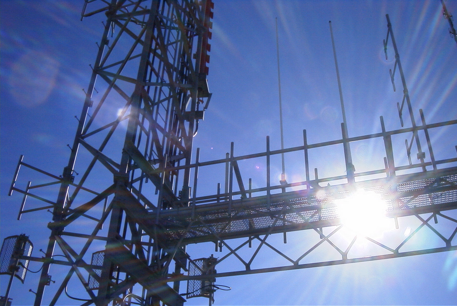
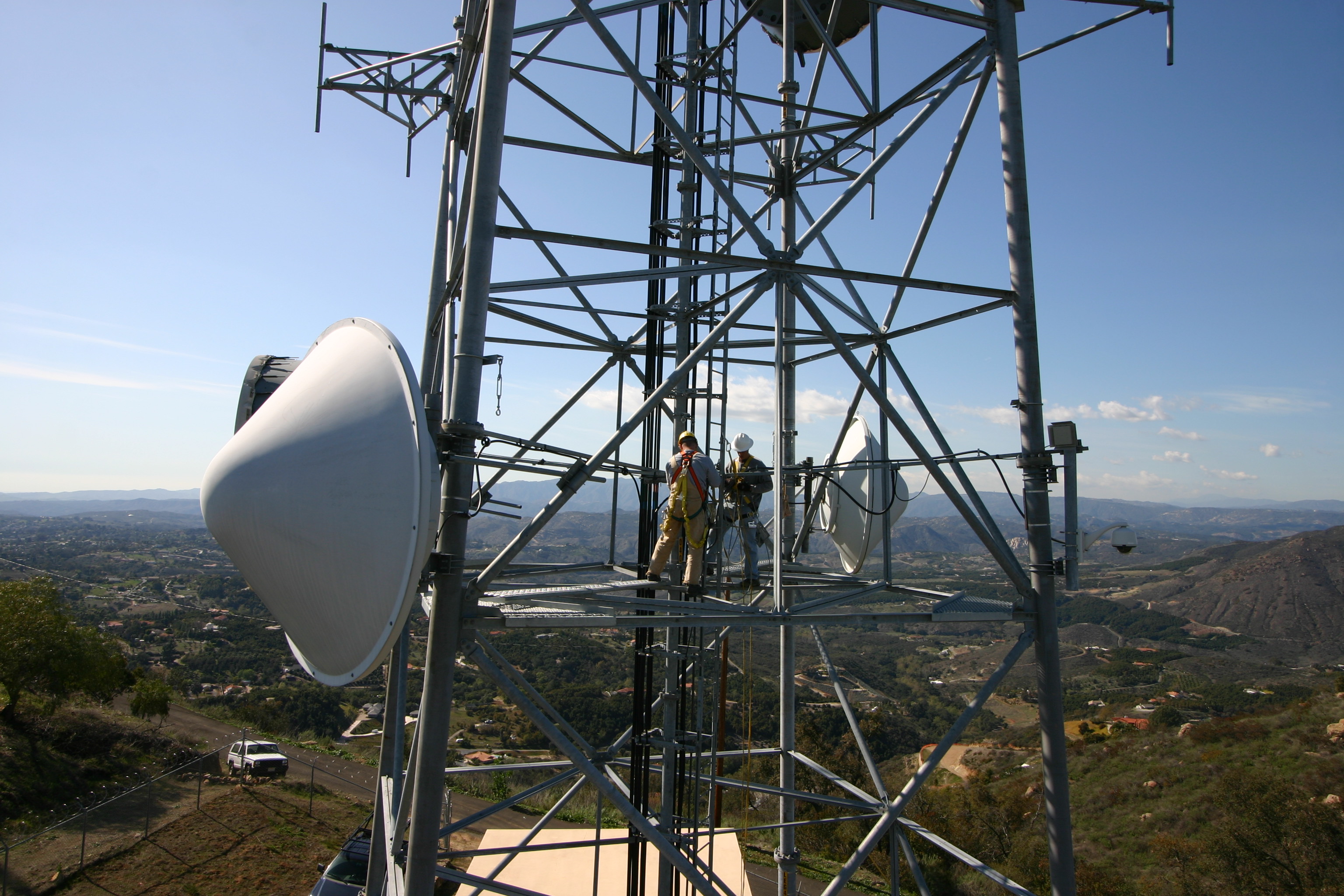
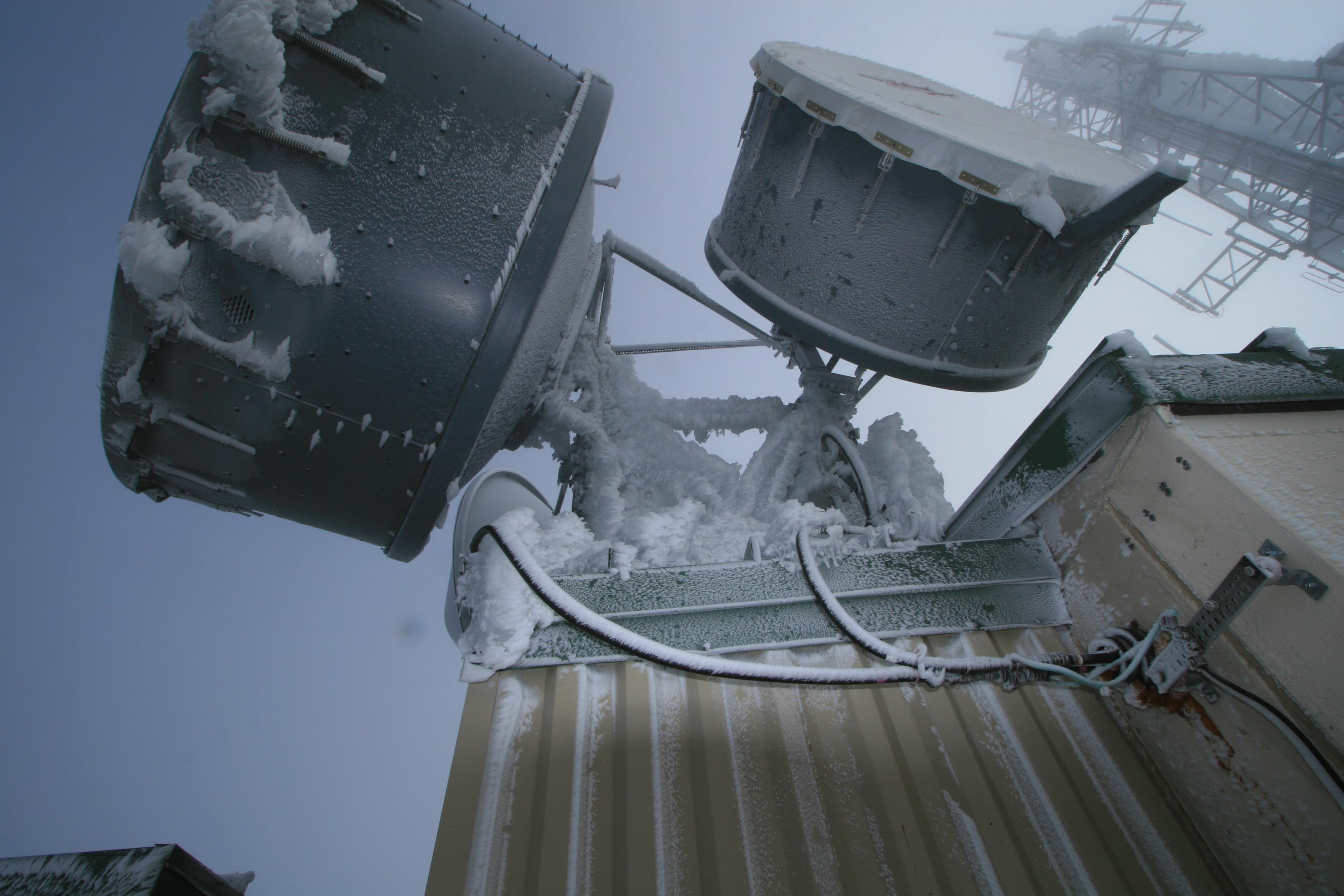
A typical collaboration scenario is that, while HPWREN supplies the backbone services and equipment, an access site usually provides the resources necessary to connect to the backbone. For example, in the case of the Palomar Observatory, Caltech has spent almost $100,000 in radio and antenna equipment alone to support the HPWREN connection. Several HPWREN collaborators also contribute in-kind, by providing staff time for installation-related activities beyond their own programmatic needs. Multiple state and local agencies host HPWREN backbone sites at their microwave tower facilities, resulting in HPWREN rental cost savings of an estimated $100,000 per year. In addition, the Lawrence Berkeley National Laboratory pays about $12,000 per year in tower site rent for a single antenna to the Palomar Observatory. Other high-impact examples include the Live Interactive Virtual Explorations (LIVE) distance education activities, a national-level technology transfer with the National Park Service, and synergetic collaborations with various local, state and federal agencies. A January 2010 example of usage of data products by news media was a time-lapse animation of HPWREN-connected camera imagery regarding flash flooding in San Diego County. This illustrated how fast flash flooding can approach, where one minute someone would just get their feet wet crossing the Santa Margarita river, and a few minutes later it is probably not survivable, as the person would likely crash into the rocks by the then strong water flow. Summary This project is centered around network research aspects and also serves as an enabling cyberinfrastructure for various science disciplines and education activities, while partnering with multiple institutions. HPWREN collaborators, alongside this project's NSF support, invested substantially into the overall environment, including by augmenting it with many projects of various scopes and sizes. Specific HPWREN research is ongoing in the areas of workload profiling, performance assessments, as well as backbone and access link Quality of Service and Policy Based Routing implementations and experimentations. Research also continues in the area of network impact-considerate intelligent sensors, forwarding data based on locally determined events, rather than continuously. The current stability and reliability of this network is a direct result of lessons learned in its multi-year development effort. This includes a significant investment in FCC-licensed spectrum radio systems, and an implementation of backbone link diversity, as well as upgrading of high-traffic links to 155Mbps capacity. Further enhancements are planned, such as a separate 45Mbps path to the Palomar Observatory, bringing its aggregate bandwidth to 200Mbps of full-duplex links. Future directions include continued research on QoS and PBR in this large-scale living laboratory of many science, education, and first responder applications, with an objective to further enhance the reliability and predictability of the networking substrate. Continued technology transfers will advance with various partners, which, among others, include the National Park Service, public safety agencies (e.g., CalFire, US Forest Service, San Diego County Sheriff's Department), and the Navajo Reservation in New Mexico. HPWREN also participated in the design and installation of an astronomy research related 100-km microwave radio data link between La Silla and Cerro Tololo in Chile, where the National Optical Astronomy Observatory (NOAO) had established a high-speed connection to the US mainland, and expects to provide similar help in the future. A further priority, in close collaboration with project partners, is the integration of additional strategically placed environmental sensors and the availability of resulting data sets. This project will also engage its constituents to evaluate strategies towards models for a more long-term sustainable infrastructure. Given current and future needs as well as opportunities for shared cyberinfrastructure, along the objectives of this project, HPWREN is still far from having reached the limits of its potential, with additional future collaborations currently being considered. Some example photos
|