"Where is the fire?"
Near real time HPWREN web-accessible camera views of panoramic vistas of mountains and valleys now available via Google Earth
Living in a fire prone area of Southern California, most of us have encountered seeing a dark plume billowing over a mountain in the distance at one time or another, always wondering, where is the fire? HPWREN's web-accessible cameras are covering a considerable portion of San Diego and parts of Riverside counties, as well as one location in Santa Barbara county. They show panoramic views of mountains and valleys, often aiding in locating a fire and assessing the fire's progress by knowing where the camera is pointed at.
With the help of the graphical interface in Google Earth, the HPWREN team developed a more comprehensive way to illustrate the approximate locations of the cameras. This could possibly aid in the faster and more accurate assessment of a fire event. The cameras' locations are displayed in Google Earth by a clickable stylized camera icon. In addition to the camera locations, other sensors, such as meteorological sensors, are listed as well. A user just clicks on either icon and the near real-time camera images or met data pops up, with the shown content usually less than one minute old. Some of the icons appear stacked if multiple sensors are in close proximity, but will separate once clicked.
The HPWREN team envisions this graphical interface as a useful tool for first responders, scientists, as well as private citizens living in this area. Combining data from multiple sources, such as camera images, weather data, and acoustics samples can become a powerful tool to illustrate and interpret what goes on and where.
The interface is available by clicking "KML sensor interface" at /cameras/ (usage of this new capability requires the installation of Google Earth).
HPWREN's network of web cameras throughout the county and beyond started in 2001 when atmospheric conditions on HPWREN's mountain top locations needed to be monitored to research the impact of weather on wireless links. Over the years, the camera network grew in coverage as well as in importance to users. The organizations utilizing the web cameras vary greatly; from first responders, the National Weather Service, news stations, to local airplane operators and private citizens checking up on possible fire threats and impacts of other events such as heavy rain and flooding.
The camera system was recently updated and expanded, as described in the article from November 9, 2017, "Augmented camera capabilities created by collaboration between multiple universities and private industry in support of fire watch activities (/news/20171109/)
Major resource contributors to the overall network system in the past included the National Science Foundation, and, more recently, the County of San Diego, as well as San Diego Gas & Electric. Additional resources were provided by Caltech's Palomar Observatory and San Diego State University.
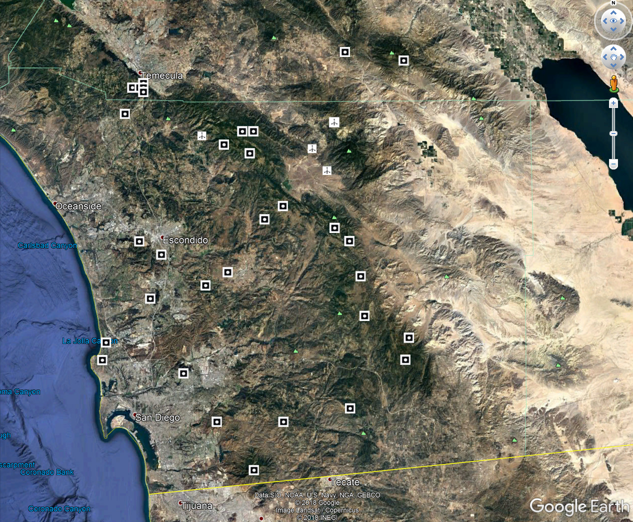
The above image shows the locations of the web cameras using the Google Earth interface.
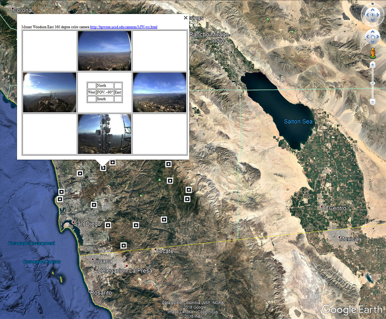
This image shows small web camera view images after the icon was clicked.
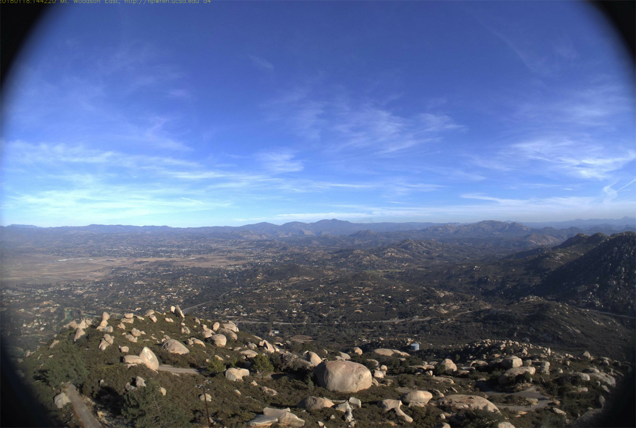
The regular web camera picture pops up once a small camera view image is clicked.
Sets of four fixed-view 90-degree camera systems, like the one shown, are pointing to the cardinal directions on mountain tops. Each camera shows separate internal color, plus more light sensitive monochrome sensors, which typically form the 360-degree views which HPWREN shows on its web site.
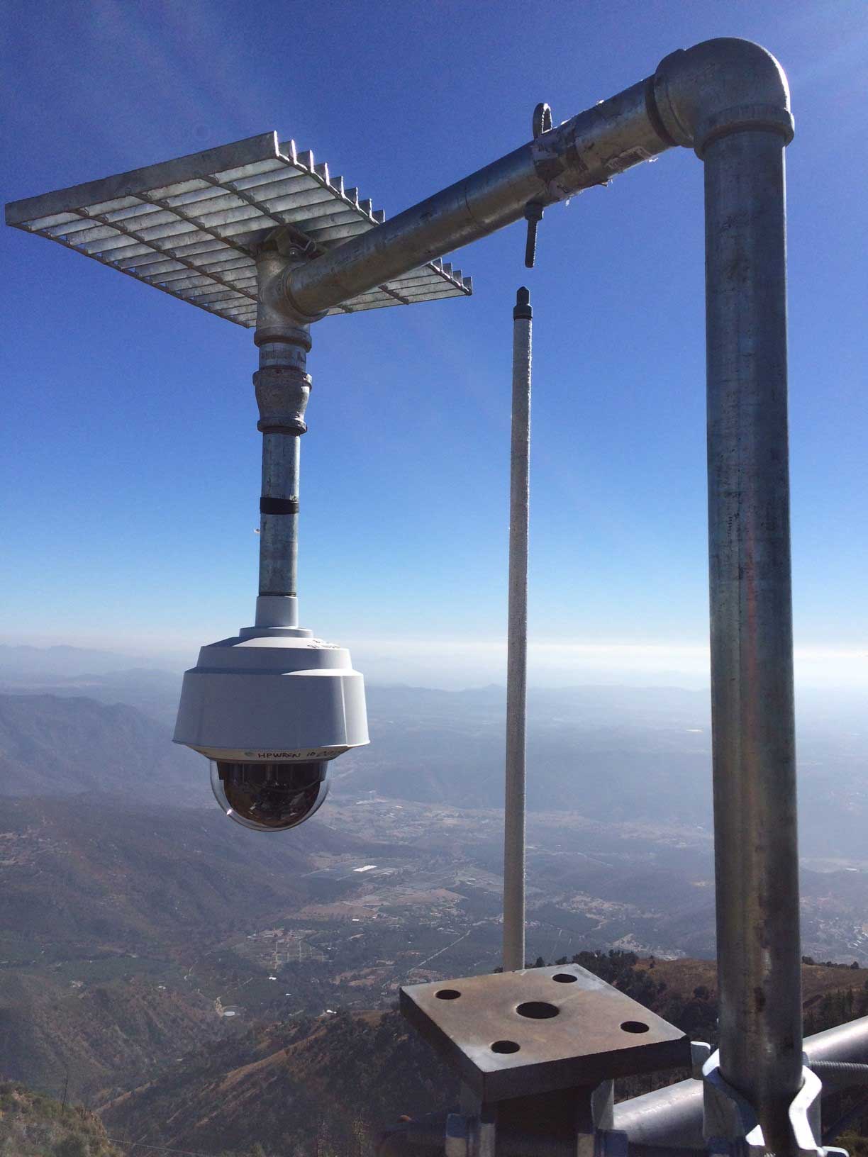
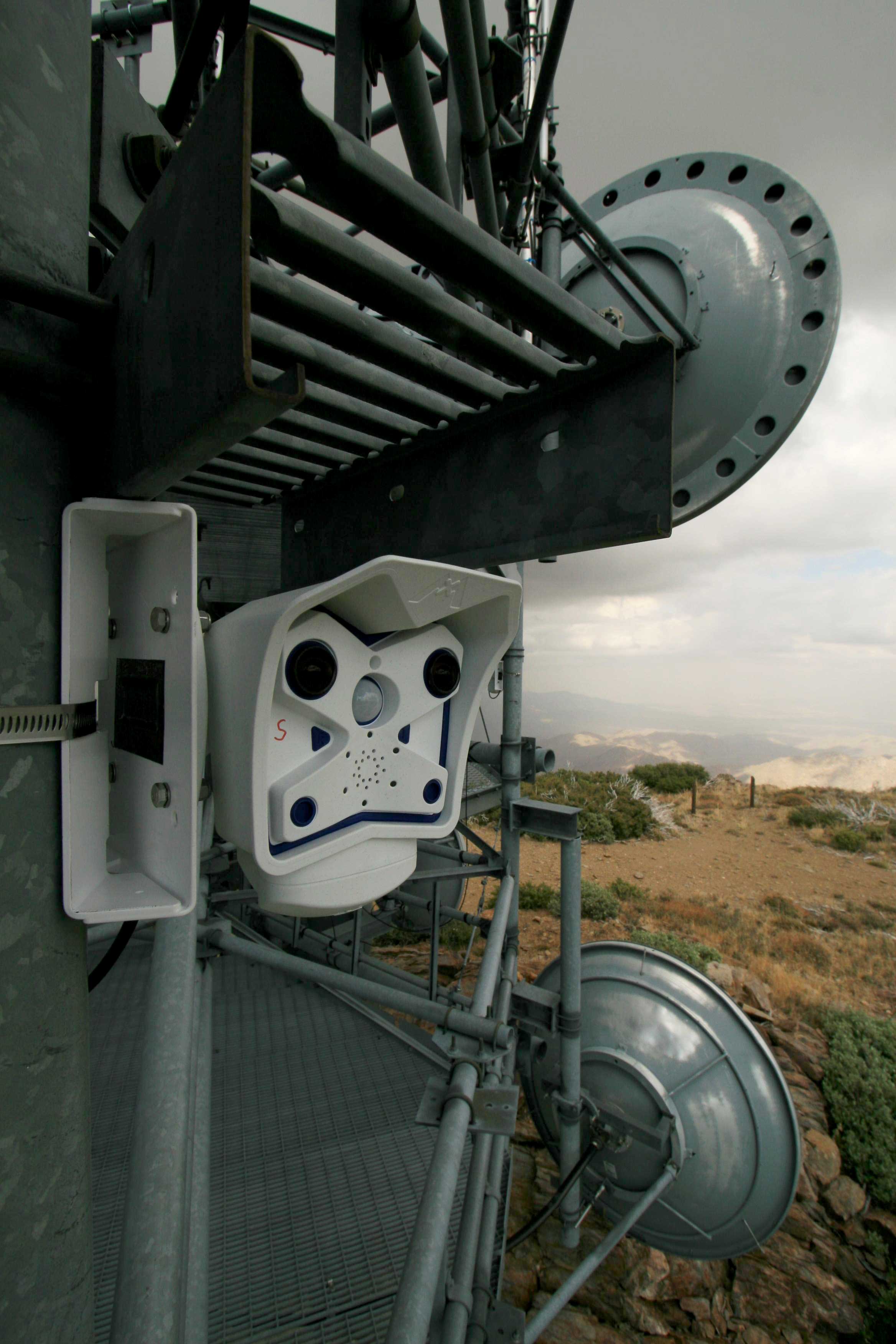
The fixed cameras on the left are augmented by ALERTWildfire pan/tilt/zoom cameras like the one shown above. Locations on multiple mountain tops utilize nine individual cameras with the image data being collected in real-time by centralized servers at UCSD and the University of Nevada, Reno Seismological Lab.