San Diego County Invests in New UC San Diego Fire Detection Networking
Higher-speed Network, New Cameras Expand County's Response Capabilities
The County of San Diego Board of Supervisors voted this week to approve an investment in system technology developed at the University of California San Diego that will improve the County's fire detection and response capabilities. The County's investment will result in the addition of new cameras and a boost in the network performance of hazard detection technology developed by the university.
The County unanimously approved $437,174 to undertake critical upgrades to the High-Performance Wireless Research and Education Network (HPWREN) and the ALERTWildfire network. HPWREN is operated by UC San Diego's Scripps Institution of Oceanography and the San Diego Supercomputer Center (SDSC) and ALERTWildfire is operated by the University of Nevada, Reno Seismological Lab.

Frank Vernon meeting with the San Diego County Board of Supervisors
HPWREN and Alert Wildfire connect firefighters with real-time fire activity information across the San Diego County back country. The network connects more than 60 fire stations and utilizes more than 170 cameras to provide high-quality, on-demand time-lapse HD or better imagery that helps spot fire outbreaks before they reach a catastrophic size. Many of these cameras have live video, time-lapse, low-light vision, and computerized image analysis capabilities, while some of them also support pan-tilt-zoom functions. Fire officials have control of cameras to monitor fires and triangulate on the location to better respond to fires at their earliest stages.
"Our firefighters use this network daily to communicate among stations and monitor conditions in times of quiet and to fight fires when they arise," said San Diego Regional Fire Authority Chief Tony Mecham. "These improvements will provide a valuable upgrade in the ability of our back country fire stations to have high-speed Internet access and share information during both routine and emergency incidents." The upgraded backbone allows for the transfer of high-speed data with fire-fighting assets in areas without reliable commercial Internet, and the cameras can be remotely controlled from the 911 dispatch center.
Initially funded in 2000 by the National Science Foundation, HPWREN was co-founded by Hans-Werner Braun, a research scientist with SDSC; and Frank Vernon, a seismologist with Scripps Oceanography who originally contacted Braun the year before about creating a faster, more reliable, and more comprehensive network as new technology allowed real-time gathering of data.
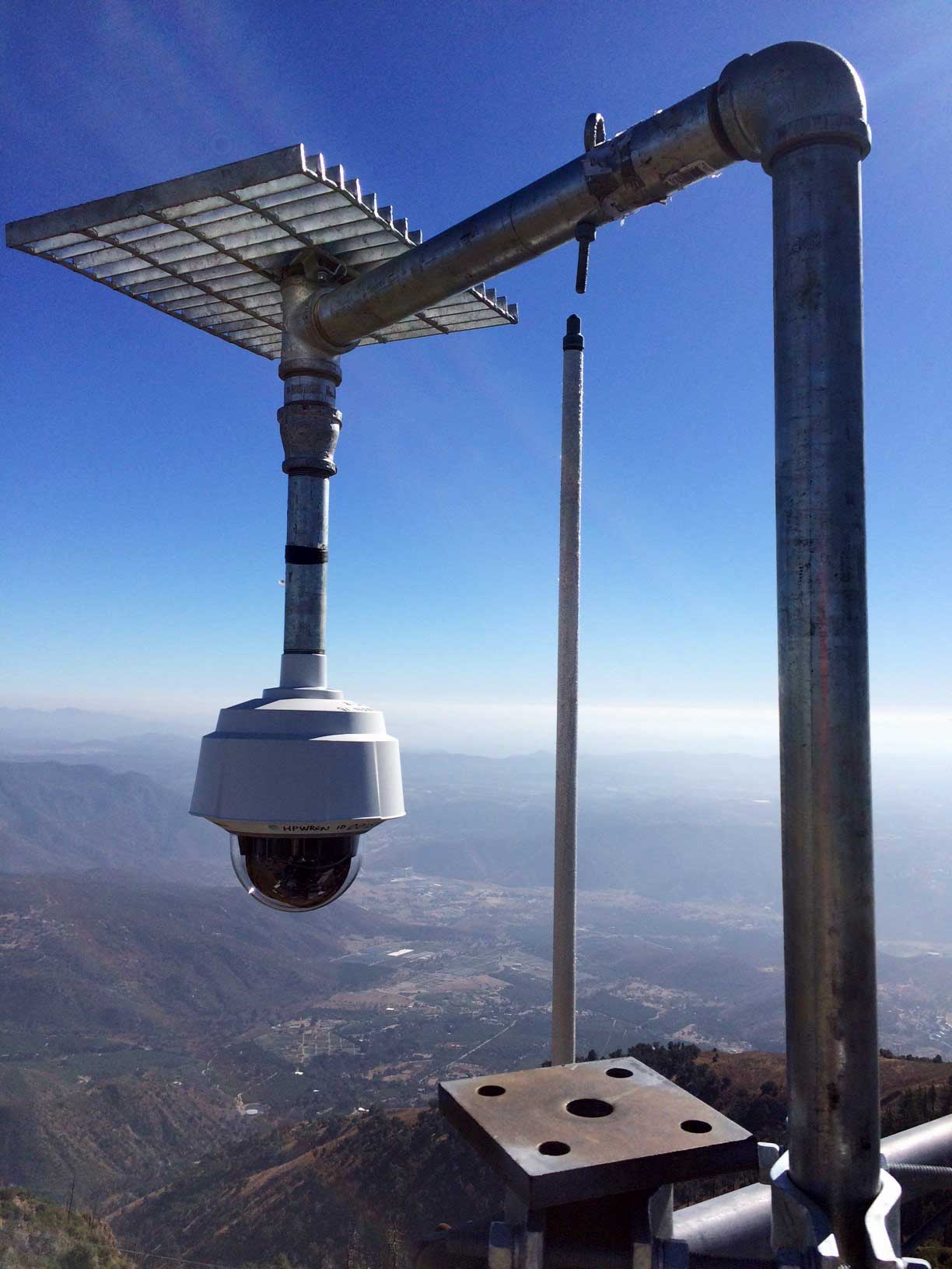
An ALERTWildfire/HPWREN Pan/Tilt/Zoom camera on one of the mountain tops.
HPWREN currently collects images from 153 fixed and 19 pan/tilt/zoom cameras, for a total of 172 imagers. With a typical image collection rate of one frame per minute, this amounts to almost a quarter million still images collected daily, or about 90 million per year. The long-term image data storage and significant computational resources, primarily provided and supported by UC San Diego's California Institute for Telecommunications and Information (Calit2), are publicly accessible via the HPWREN web site. This does not include image streams collected at much higher frame rates, e.g., during fires, which brings the total number of frames collected from the network's cameras to well beyond the 90 million per year. Images can be viewed at /cameras, http://www.alertwildfire.org/sdge, and http://www.alertwildfire.org/socal.
The County of San Diego investment will allow critical upgrades to the HPWREN telemetry equipment. In 2000, HPWREN used state-of-the-art microwave telemetry of 45 Mbps (megabits per second) but technology has significantly improved in the intervening years. These investments will increase bandwidth to 220-500 Mbps, providing significantly improved broadband speeds allowing for better coverage of the county and improved Internet service connecting the more than 60 connected remote fire stations in San Diego County.
Additionally, five new camera locations will be added to the network, atop mountains at Sierra Rojo, Cowles Mountain, Cuyamaca Peak, North Peak, and White Star. These locations will now receive increased hazard detection coverage with high-resolution and pan/tilt/zoom cameras.
"Scripps Institution of Oceanography is committed to research programs that support the community's resilience to hazards," said Margaret Leinen, vice chancellor for Marine Sciences at UC San Diego and Director at Scripps. "As the County of San Diego and State of California face a longer fire season and continued impacts on public safety, I am encouraged by the leadership the Board of Supervisors has shown with its investment to enable this region to be more responsive to wildfire threats than ever before."
This investment by the County of San Diego follows upgrades to the network announced last November by San Diego Gas & Electric (SDG&E). The 15 high-definition Alert SDG&E Cameras are installed in San Diego's most fire-prone areas, accessible to fire agencies and the general public at http://www.alertwildfire.org/sdge
"In an era of more extreme weather conditions, we have a duty to arm the brave firefighters sent to the front lines with the kind of accurate and timely information this technology will provide," said San Diego County Supervisor Ron Roberts, who along with Chairwoman Kristin Gaspar brought forward this request.
The UC San Diego system has proven to be an extremely useful resource during fire emergencies, including the recent Lilac Fire. County staff at the Emergency Operations Center had immediate visibility of the fire from two different Alert Wildfire camera angles within seconds of the fire being reported. Being able to see the fire and its movement patterns can provide the necessary intelligence for fire officials to make quick response decisions.